
St. Louis digital twin redevelopment now has a street-level test in The Ville: a 3D fly-through model that lets residents see proposed housing, job centers and corridor work before cement is poured. The St. Louis Development Corporation (SLDC, the city economic development agency) built the tool for the MLK Corridor, a priority area tied to its Economic Justice work, and the model is drawing attention because it turns redevelopment from a map on a wall into something neighbors can question block by block.
The stakes changed after the May 16, 2025 tornado cut through North St. Louis. A model first pitched as planning technology now doubles as a recovery screen, showing where vacant land, damaged property, workforce projects and new housing might meet.
The Map Gives Residents a Concrete Target
The first useful thing about the model is modest: it makes a promise visible. In SLDC’s MLK Corridor digital twin announcement, the agency said it engaged Houseal Lavigne, an urban planning and geospatial design firm, to build a hyper-local digital twin for the corridor.
The model highlights the former Killark Electric site, the Advanced Manufacturing Innovation Center St. Louis, and the 4theVille Cultural Boulevard neighborhood plan. That mix matters. One part is workforce training, one part is advanced manufacturing, and one part is cultural memory in a neighborhood that has heard many future-tense promises before.
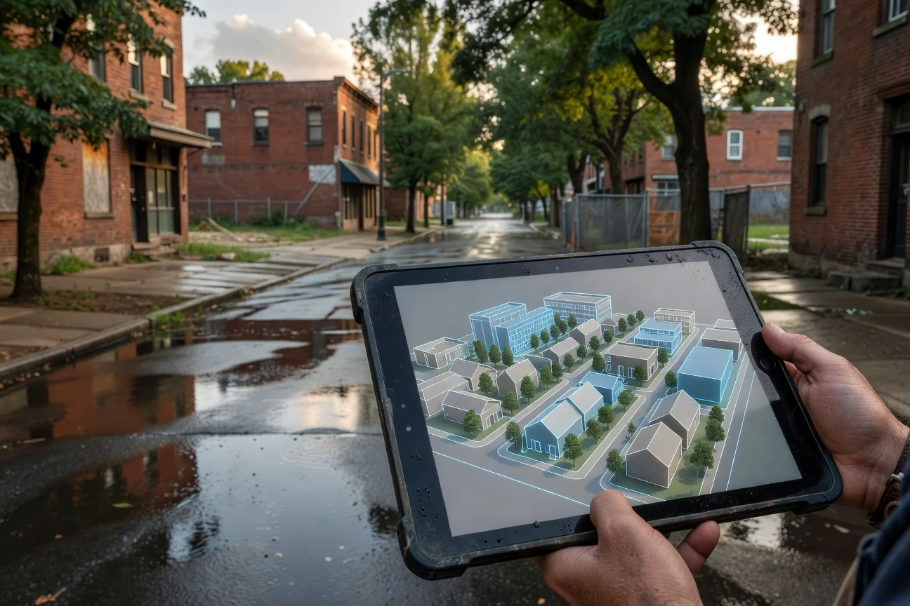
The idea was to show the vision, before and after, of what the neighborhood could look like
Steve Davis, vice president at SLDC, gave that line in Esri’s St. Louis digital twin case study. Esri, the geographic information system (GIS, mapping data tied to location) company, said Houseal Lavigne used ArcGIS Maps SDK for Unreal Engine to import city GIS data into an interactive model that can be explored like a video game.
The Ville Carries the Weight of Past Plans
The Ville is small enough to map in detail and important enough that every parcel carries history. The city says The Ville neighborhood overview covers a roughly nine-by-five-block area bounded by Taylor Avenue, St. Louis Avenue, Sarah Street and Martin Luther King Drive.
Those boundaries hold a larger St. Louis story: segregation, Black institution building, then population loss after restrictive covenants fell and investment patterns shifted. A digital model cannot repair that record by itself. It can, however, make the next round of decisions harder to hide inside planning jargon.
- Nine by five blocks define the official neighborhood footprint.
- 1876 is the year St. Louis annexed the area once known as Elleardsville.
- 95 percent was the Black share of the neighborhood’s population after The Ville became a premier African American neighborhood by 1930, according to the city.
- 38 percent was the drop in total population between 1950 and 1970, also cited by the city.
That history is why a fly-through model has to be more than persuasive. If residents can pause it, interrogate it and compare it with public commitments, it becomes a form of civic memory.
The Corridor Now Has Money and Anchors
The model lands at a moment when St. Louis is trying to direct public money toward places that were left out of older growth cycles. SLDC says the city has $246 million in city and federal American Rescue Plan Act (ARPA, federal pandemic recovery funding) commitments tied to economic justice work. In a separate Economic Justice Action Plan update, the agency listed $301 million of state and local ARPA funds invested across the city before the end of 2026.
The anchor project closest to the digital twin is The Monarch on MLK. SLDC says the Land Clearance for Redevelopment Authority (LCRA, a city development board staffed by SLDC) bought a 150,000-square-foot building at 3940 Dr. Martin Luther King Drive in 2023, plus 29 surrounding vacant parcels. The agency also says another 79 parcels owned by the Land Reutilization Authority (LRA, the city’s land bank) sit within a six-block area of the site.
| Piece of the Plan | What It Adds | Scale or Location |
|---|---|---|
| MLK Corridor Digital Twin | Shared visual model for residents, planners and partners | Priority demonstration area along Martin Luther King Drive |
| The Monarch on MLK workforce hub | Training, small business support and public agency presence | 3940 Dr. Martin Luther King Drive |
| Advanced Manufacturing Innovation Center St. Louis | Manufacturing research, prototyping and workforce pathways | Near Finney Avenue and the North City manufacturing district |
| Modular Housing Pilot | New homes on city-controlled vacant lots | Proposed 4100 to 4200 blocks of Aldine Avenue |
The table shows why the model matters. Residents are not being asked to imagine one building. They are being asked to judge whether several projects can add up to a neighborhood plan instead of scattered wins.
The Tornado Turned Visualization Into Recovery Infrastructure
The recovery layer became harder to ignore after the 2025 storm. The National Weather Service (NWS, the federal weather agency) said the May 16 St. Louis tornado touched down near Clayton at 2:41 pm, reached Enhanced Fujita scale (EF, a tornado damage rating) 3 intensity in the northern portions of the city, and produced maximum winds up to 152 mph. The NWS storm survey also said thousands of buildings were damaged in St. Louis.
That turns the digital twin into more than a redevelopment exhibit. Used well, it can help residents and officials compare rebuilding decisions with earlier promises, especially where storm damage overlaps with vacant lots and planned investment.
- Show whether damaged blocks are being prioritized or bypassed.
- Layer city-owned parcels against proposed housing sites.
- Test how road, water, sewer and power work might affect construction timing.
- Let residents flag gaps between the visual model and street conditions.
The danger is false certainty. A clean 3D block can make a complicated parcel look ready, even when ownership, insurance, code compliance or financing remains unsettled.
The Risk Is a Beautiful Model With Old Power Rules
A fly-through can smooth over conflict if city leaders treat it as marketing. In The Ville, its value depends on whether residents can use it to ask sharper questions: Who owns this parcel? Which project is funded? What changed after the storm? Which promise moved from concept to contract?
Three friction points matter most. Access comes first, because a digital model cannot improve public trust if residents only see it during curated presentations. Assumptions come next, because models carry choices about density, traffic, design, rent, trees and parking. Governance is the final test, because someone has to update the model when plans change.
This is where the overlooked stakeholder is not the software vendor or the developer. It is the neighbor who has enough local knowledge to know when a rendering feels wrong. The best version of the tool gives that person a way to make the record better.
A Fly-Through Becomes a Public Record
Harvard’s attention gives St. Louis a useful outside nod, but the local measure is simpler. The model succeeds if residents of The Ville can point to a screen and say whether the next street, house, sidewalk or training center matches what public officials promised.
If SLDC keeps the model current as projects shift, it can become a running public record for the MLK Corridor. If updates lag behind decisions, the same tool will age into another polished presentation that residents remember for what it left out.
The first screen sells a future. The next version has to remember every promise attached to it.