
Looq AI, a fast-growing player in ground-based 3D capture, has expanded its international footprint with seven new partnerships across North America, Europe and Asia, giving surveyors, engineers and utilities a way to collect field data faster, safer and with much greater precision. The company says its expanded network instantly puts its survey-grade platform into the hands of global infrastructure teams who need reliable reality capture when aerial systems fall short.
Professionals working on power grids, utility corridors, road design, or complex topography face huge demand for accurate point-cloud data. Looq AI claims its platform replaces multi-tool jobs that once required laser scanners, aerial drones, manual pole measurements and repeated site visits. Now, projects can be completed with a single ground-based device that captures consistent data and cuts engineering costs in days, not weeks.
Partnerships Span Three Regions With Different Priorities
Looq AI’s newest regional partners include AllTerra Central, LiDAholics, Monsen Engineering and Terrain LLC across the U.S., ECOGIS and Geometius in Europe, and IRIS STAR Technologies across India and Gulf states.
One short line.
That’s a major distribution jump for a field-first tech product.
In North America, new partners will serve markets in Texas, Oklahoma, Arizona, New Mexico, the Seattle area, Utah, Nevada and the Northeast. Europe’s relationships strengthen operations in Poland, Croatia, the Netherlands, Belgium and Luxembourg. In Asia, IRIS STAR brings the platform to India and GCC countries for infrastructure inspection, railway mapping, digital twins, and large-scale surveying.
A one-sentence paragraph.
Each market is hungry for faster field-to-office workflows.
Under Looq’s model, users get complete datasets without risking expensive rework, missed assets or safety problems. Traditional workflows often require multiple devices, manual pole checks or fragmented file formats, which makes documentation slow and costly.
Why Ground-Based Capture Matters More Than Drones
A short paragraph.
Aerial mapping is convenient but has blind spots.
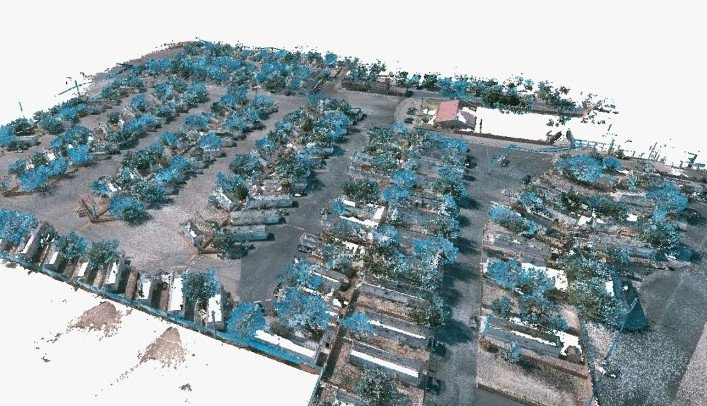
Drones struggle under tree cover, inside substations, around tight urban corridors, along rail tracks or beneath bridges. Ground-level mapping gives engineers clean, survey-grade dimensioning where aerial methods simply cannot see. Looq AI’s handheld platform offers 3D point clouds that capture poles, cross-arms, vegetation, clearance measurements and terrain with consistent accuracy.
Looq says a unified ground-based workflow reduces safety risk for field teams because one technician can scan from safe access roads or boundaries rather than climbing structures or walking beneath energized lines.
A brief table illustrates where users see the biggest gains:
| Workflow Challenge | How Ground-Based Capture Helps |
|---|---|
| Vegetation or obstructions block drone views | Full line-of-sight from street level |
| Manual pole surveys slow and dangerous | Single tech scans safely at a distance |
| Multiple tools required | Unified platform replaces several |
| Missed assets cause rework | Complete point cloud prevents gaps |
| Engineering backlogs | Faster drafting from clean linework |
One-sentence paragraph.
Engineering firms save time, avoid return trips, and improve insurance outcomes.
A Platform Built for Digital Twin Growth
Looq’s handheld system integrates creation, visualization, 3D feature analysis and data export into a single workflow. That means field teams collect survey-grade data and immediately convert it into engineering-ready formats for mapping corridors, planning upgrades, modeling clearances or drafting topographic plans.
A short line.
The product is being positioned as a “virtual surveyor” rather than a gadget.
For utilities, railroads and developers, consistent point clouds help reduce measurement errors and speed up permitting or asset documentation. Instead of juggling raw scans, CAD files, drone imagery and spreadsheets, engineers receive a single platform to control linework, draft features and export clean deliverables.
Bentley Integration Gives Platform Real Weight
Looq AI designed its point clouds to work directly inside Bentley applications, including MicroStation and PLS-CADD, which are common tools in power, transportation, and structural engineering. The integration matters because engineering teams can move from field scans to overhead clearance modeling, pole inventory, line design or terrain drafting without guessing or patching mismatched scans.
A one-sentence paragraph.
The tech plugs neatly into the software engineers already use.
A shared customer, Aquawolf, won a Bentley Systems Founders’ Honor Award after integrating Looq data into PLS-CADD and improving utility-pole modeling efficiency by more than 60%. That success story gives Looq something tangible: measurable savings, recognized by one of the biggest names in infrastructure software.
Short paragraph.
Awards signal real adoption, not hype.
Aquawolf’s work shows how structured point-cloud capture accelerates design, reduces field revisits, and improves documentation when inspecting transmission structures or preparing corridor upgrades.
Next-Generation Field Workflows
Looq’s platform lets users code 3D features in real time, draft clean linework, and control datasets virtually before they ever reach the engineering office. Field staff can scan once, then collaborate across departments without repeating surveys or stitching external imagery.
Short line.
That’s a major change from old asset data routines.
Engineering firms often spend weeks reconciling multiple instruments — handheld GPS, corridor drones, tripod lidar and physical measurement notes. Looq’s unified process turns this into a predictable digital model.
One sentence.
It’s not just faster — it’s cleaner.
A few benefits highlighted by users:
-
reduced time spent reconciling mismatched data
-
fewer safety risks in energized or hard-to-reach locations
-
accurate linework without needing multiple site visits
And a short one.
Office teams make decisions earlier when their data is trustworthy.
Why Demand Is Rising Now
Critical infrastructure operators — from electric utilities to pipeline firms — need survey-grade field data more often. Aging assets, weather risks, grid modernization and vegetation management all require faster digital mapping. Many utilities face long inspection backlogs and heavy documentation requirements for compliance or capital planning.
One-sentence paragraph.
Scaling digital twins requires standardized point-cloud data, not just drone flyovers.
Ground-based systems do not replace aerial methods entirely. They complement them, especially where topography or dense assets block aerial views. Looq’s value is in combining safety, reliability and precision rather than trying to make drones do everything.
Looq Positions Itself as System-Level Infrastructure Tech
The company’s partners across three continents show that digitization of infrastructure is no longer niche. As customers transition to predictive maintenance, vegetation analytics, and grid modernization, field-accurate 3D datasets are becoming foundational to long-term planning.
A single-sentence paragraph.
Standards matter when hundreds of utilities push toward digital twins simultaneously.
With more global network coverage, Looq AI expects adoption to speed up in power transmission, telecom, roads, construction planning, new build corridors, and multi-stakeholder projects that need a shared representation of infrastructure.
The company says measurable ROI comes quickly when engineering, surveying and asset management teams avoid rework and reduce drafting time.