
Ford and Google have pulled off a rare feat: putting nearly the entire 6,000-mile TransAmerica Trail on Street View. The unlikely collaboration took a Ford Bronco, a Google camera rig, and a month of dirt, dust, and long days to map one of America’s wildest overland routes.
A Coast-to-Coast Trail That Mostly Exists Off the Pavement
The TransAmerica Trail isn’t a highway you stumble onto.
It’s a stitched-together line of forest roads, jeep tracks, and unpaved routes created by Sam Correro in the 1980s.
Most Americans drive coast-to-coast in a day or two on smooth interstate asphalt.
The TAT laughs at that idea.
The full route stretches close to 6,000 miles and crosses terrain that can shift from powdery desert to thick mud.
Optional spurs add even more adventure for those brave or curious enough.
One short sentence here to break the pace.
Unlike national parks or scenic byways, the TAT has no signs pointing the way.
You navigate with maps, GPS files, or a keen sense of direction — sometimes all three at once.
It has become a rite of passage for overlanders, off-road riders, and anyone who wants a sense of what travel felt like before America filled itself with concrete.
Ford and Google Take the Challenge Head-On
This year, Ford and Google teamed up to chart the primary TransAmerica Trail with Street View precision.
That meant sending a small convoy off pavement for more than a month.
The company bolted a compact next-generation Street View camera onto a Bronco Badlands, while a Ranger Lariat and Expedition Tremor carried crew members, spare gear, fuel, food, and sleeping setups.
It wasn’t a quick press trip.
It was a slow crawl across rugged terrain.
They began at the Oregon coast in August and finished in North Carolina more than 30 days later.
The goal wasn’t speed. It was accuracy — and maybe a little fun along the way.
Here’s one bullet point that adds clarity to the mission:
– This mapping run officially brings the TAT into the digital era, making it viewable for anyone with an internet connection.
The Machines Behind the Mission
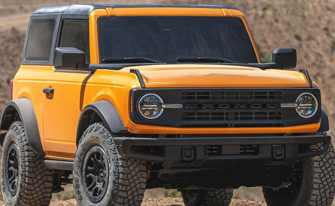
The Bronco Badlands carried the Street View camera and took the brunt of the hard miles.
Its setup included 35-inch all-terrain tires, Ford’s G.O.A.T. drive modes, extra ground clearance, and a punchy 330-horsepower V6.
The more remote sections required steady throttle, careful wheel placement, and enough patience to climb to high passes like Ophir at 11,789 feet.
Weather can change everything up there.
One simple line here.
To capture the scale of the vehicles and their roles, here’s a straightforward table:
| Vehicle | Key Role | Notable Features |
|---|---|---|
| Bronco Badlands | Street View mapping | 35-inch tires, V6 engine, high clearance |
| Ranger Lariat | Support / transport | Strong payload, crew logistics |
| Expedition Tremor | Gear + team shuttle | Camping setup, towing & hauling |
Those vehicles covered ground most mapping vans could never touch, which is exactly why Google needed Ford’s off-road lineup.
Why Map a Trail Most People Will Never Drive?
For one thing, the TAT has become a quiet cultural symbol for the overland community.
It represents the idea that there’s still space in America where you can travel for hours without passing a gas station or seeing a billboard.
Digitizing it doesn’t replace the adventure.
But it does make it accessible for people who may never leave the highway.
There’s also a broader purpose.
Google has been expanding Street View into more remote regions to build a fuller picture of landscapes — and help emergency planners, conservationists, and travelers understand terrain conditions.
One sentence alone to keep things human.
The Spirit of the Trip: A Month in America’s Backroads
Images from the trek show dust clouds, pine forests, river crossings, small towns, and wide-open plains.
Some shots feel like they’re from another century.
The team camped often, cooked over fire pits, and woke up to cold mornings on mountain ridges.
They also hit sections where weather forced rerouting — snow in the Rockies, mud in the plains, storms in Tennessee.
At least one small paragraph belongs here.
The TAT isn’t static. It changes with the seasons, and some stretches simply can’t be passed depending on the month.
Google’s public notes even warn users that the route shown isn’t a guarantee, just a snapshot of what was passable in 2025.
A Big Win for Off-Road Fans and a Digital First for the Trail
With Street View coverage now in place, adventurers can preview terrain, plan campsites, or decide what vehicle they need.
Some will use it to prepare for their own rides.
Others will use it just to see what lies out there between the two coasts.
The TAT, once hidden behind old-school maps and whispers between off-road riders, is now accessible to anyone with a screen.
Not the same as riding it — but still something special.
And, actually, it’s kind of wild that a camera on a Bronco now holds one of the most complete visual records ever made of America’s backcountry.